Somaliland is home to approximately six million people and occupies an area of 176,000 square km, which makes about three quarters the size of Britain. It borders Somalia to the east and is not recognised as an independent state by any country except Israel.
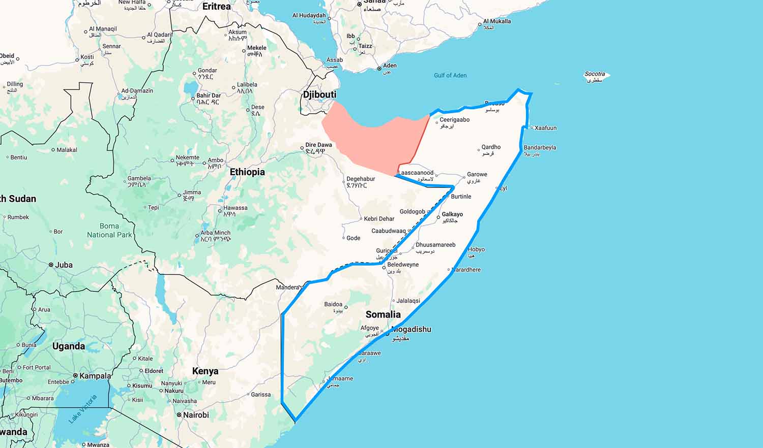
The area edged blue in this map is Somalia. From Somalia’s point of view the blue line continues around the pink area. In the view of Somaliland the pink area is Somaliland.
Somaliland is not a breakaway province of Somalia. Rather, in the late 19th century, the Somali sultanates were colonised by the Italian and British empires, who created two colonies from the tribal territories: Italian Somaliland and British Somaliland.
Britain formally granted independence to the State of Somaliland in June 1960, and almost immediately Somaliland voluntarily united with the former Italian Somaliland to form the Somali Republic.
Things didn’t go smoothly, however, and the union didn’t last. Eventually war broke out, and after ten years Somaliland declared independence in 1991.
Israel recognised Somaliland as an independent state last December. To cement that, the first official delegation from Somaliland arrived in Israel on Monday 23rd February 2026.
So from 1991 until last December, Somaliland has been in a nether world of being home to its people but not recognised as a country.
That is not to say it was ignored, because it has relations with a number of countries. But by making the step to formally recognise Somaliland, perhaps Israel will cause the floodgates to open.
Israel has reason to want a partner in the Horn of Africa. It helps to counter Iranian-back Houthis in Yemen. But as of just a day or two ago, that dynamic has changed with the US and Israeli attacks on Iran. That said, a partner is a partner, particularly in this changing world. I guess the parties probably stressed that when they met.